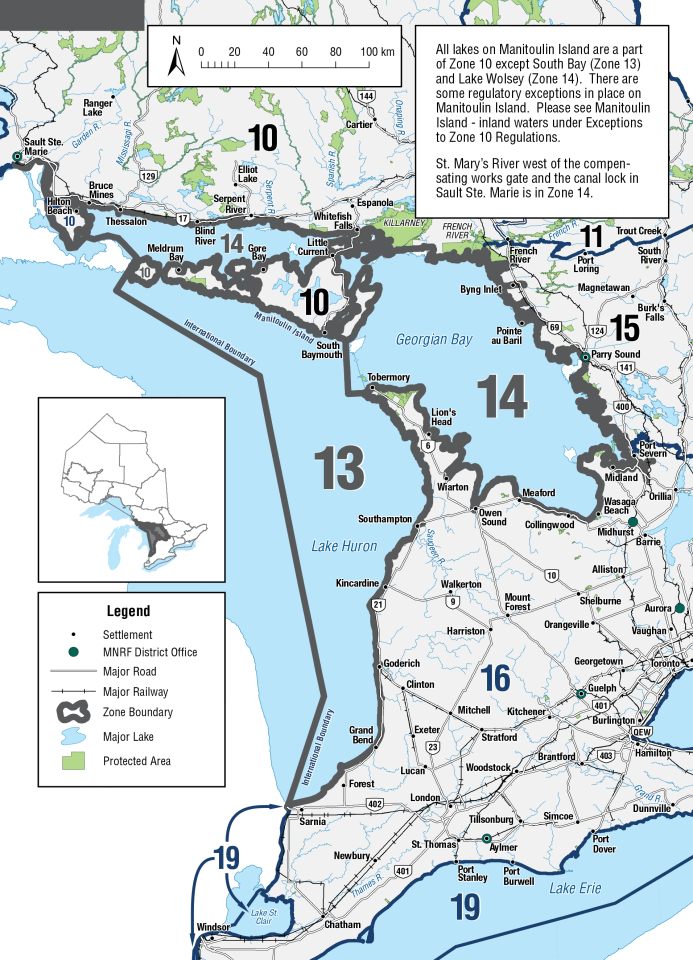
Big Sound of Parry Sound - waters of the Big Sound in Georgian Bay, in the District of Parry Sound. Western boundary line from Cadotte Point on Parry Island to the easternmost point of Killbear Provincial Park. Southern boundary is the swing bridge connecting Rose Point to Parry Island, including Parry Sound Harbour, Hay Bay, Deep Bay and Depot Harbour.
- Only one line may be used when angling through the ice.
- Lake Trout - open from January 1 to September 30.
- Lake Trout - S-0 and C-0; from January 1 to February 7 and April 1 to June 23 and September 1 to September 30.
- Lake Trout - S-1 and C-1; must be less than 61 cm from February 8 to March 31 and June 24 to August 31.
Big Sound of Parry Sound - waters west of the Killbear Channel in Georgian Bay, in the District of Parry Sound. Eastern boundary from Cyril Point to the southwestern most point of Spruce Island to the light house located immediately north of the Nias Islands to Liddon Point of Parry Island. Western boundary from Oak Point to the lighthouse on Jones Islands to the lighthouse on Gordon Rocks to the most northerly point of Snake Island to the lighthouse on Snug Island due east to the mainland.
- Lake Trout - open from January 1 to September 30
- Lake Trout - S-0 and C-0; from January 1 to February 7 and April 1 to June 23 and September 1 to September 30
- Lake Trout - S-1 and C-1; must be less than 61 cm from February 8 to March 31 and June 24 to August 31
Big Sound of Parry Sound (Killbear Channel) - The waters of the Killbear Channel in Georgian Bay, in the District of Parry Sound. Eastern boundary line from Cadotte Point on Parry Island across the channel to the easternmost point of Killbear Provincial Park. Western boundary line from Cyril Point to the southernmost point of Spruce Island to the lighthouse located immediately north of the Nias Islands to the southernmost point of Rose Island to Liddon Point on Parry Island.
- Lake Trout - closed all year
- For additional clarity on regulations in Big Sound of Parry Sound please see the map located at Fisheries Management Zone 14 (FMZ 14)
Iroquois Bay of the North Channel of Lake Huron
- Fish sanctuary - no fishing from January 1 to April 30
- Lake Trout - S-1 and C-0; must be less than 51 cm ( 20" ) and possessing a fin clip with a healed scar
St. Marys River - from the gates of the Compensating Works downstream to longitude 83°45′W., which extends from Eagle Point (Hay Bay) south to the international boundary with the United States
- Two lines may be used when trolling from a boat in open water
- Northern Pike - any size
- Walleye - open from January 1 to last day in February and May 15 to December 31
- Walleye - S-4 and C-2; any size
St. Marys River (Lake George) - Laird Township, from Pumpkin Point upstream to the Laird Township boundary
- Walleye - S-0 and C-0 from April 1 to June 15, Zone-wide seasons and limits apply for remainder of year
