Last Updated: December 31, 2024
  • There are a number of brook trout and lake trout waterbodies that have species-specific regulations in addition to restrictions related to gear, bait and fish sanctuaries. These additional restrictions are applicable to the waterbody, regardless of what species is/are being targeted. See species exceptions for more details.
  • The following waterbodies, or portion of them, have different regulations that are listed in the waterbody exceptions: All waterbodies in Algonquin Park, Bonnechere River, Calabogie Lake, Carmichael Lake, Jack Lake, Kushog Lake, Lake Clear and Little Lake Clear, Madawaska River, Mud Lake, Murphy’s Lake (Arabis Lake), Royal Lake, Slipper Lake, South Wildcat Lake, Stocking Lake, Stoney Lake, Trout Lake, Wendigo Lake
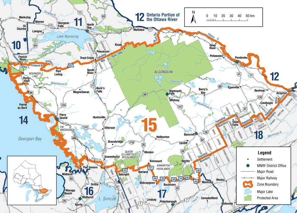
  • FMZ 15 is part of the Central Bait Management Zone (BMZ). Live or dead baitfish or leeches may not be transported into or out of a BMZ. These rules do not apply to baitfish and leeches which are both dead and preserved.

Zone-wide Seasons and Limits

  • Not in Season
  • Open in Limited Locations
  • Open Season
Show All

Atlantic Salmon

Atlantic Salmon
Season Start Date
Season End Date
Closed to fishing
Closed to fishing

Closed all year

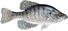
Black Crappie

Black Crappie
Season Start Date
Season End Date
Sport Limit
30
Conservation Limit
10

Total daily catch and possession limit for white and black crappie combined.

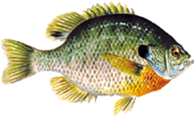
Bluegill

Bluegill
Season Start Date
Season End Date
Sport Limit
50
Conservation Limit
25

Pumpkinseed, Bluegill, Green Sunfish, Northern Sunfish, and Orange-spotted Sunfish limits combined

Brook Trout

Brook trout
Season Start Date
Season End Date
Sport Limit
5
Conservation Limit
2

Total daily catch and possession limit for all trout, salmon and splake species combined

Brook trout
Additional Fishing Opportunities
Season Start Date
Season End Date
Sport Limit
5
Conservation Limit
2

Additional Fishing Opportunities

  • Aide Lake (45°00′35″N., 77°33′12″W.) - Cashel Township
  • Barns Lake (45°36′19″N., 78°08′15″W.) - Murchison Township
  • Black Cat Lake (45°11′01″N., 78°41′52″W.) - Sherborne Township
  • Bronson Lake (45°02′31″N., 77°46′02″W.) - Dungannon Township
  • Burdock Lake (45°10′21″N., 78°35′11″W.) - Guilford Township
  • Burnt Lake (45°01′37″N., 77°53′07″W.) - Faraday Township
  • Burnt River (44°53′N., 78°38′W.) - Snowdon Township
  • Cat Lake (45°10′37″N., 78°40′47″W.) - Stanhope Township
  • Cedar Lake (44°58′38″N., 77°45′53″W.) - Dungannon Township
  • Centre Lake (45°00′51″N., 78°03′00″W.) - Cardiff Township
  • Cherrytree Lake (45°04′12″N., 77°36′21″W.) - Mayo Township
  • Davis Pond (45°18′55″N., 77°48′23″W.) - Wicklow Township
  • Doe Lake (44°56′26″N., 78°53′54″W.) - Anson Township
  • Dovetail Lake (45°01′13″N., 77°37′24″W.) - Mayo Township
  • East Chainy Lake (45°12′25″N., 78°04′16″W.) - McClure Township
  • Finger Lake (45°35′13″N., 77°48′27″W.) - Dickens Township
  • Fish Lake (45°32′29″N., 77°50′48″W.) - Dickens Township
  • Gil Lake (44°53′07″N., 78°10′21″W.) - Anstruther Township
  • Glennie’s Pond (45°12′48″N., 78°46′14″W.) - Sherborne Township
  • Green Canoe Lake (45°10′44″N., 78°28′00″W.) - Harburn Township
  • Green Lake (45°28′30″N., 77°59′25″W.) - Lyell Township
  • Harburn Lake (45°12′46″N., 78°26′41″W.) - Harburn Township
  • Hardings Lake (45°00′19″N., 78°04′57″W.) - Cardiff Township
  • Hicks Lake (45°22′27″N., 77°49′27″W.) - Bangor Township
  • Ike’s Pond (45°11′37″N., 78°27′51″W.) - Harburn Township
  • Inright Lake (45°23′25″N., 77°51′21″W.) - Wicklow Township
  • James Lake (45°21′25″N., 77°43′36″W.) - Bangor Township
  • Ketch Lake (45°01′48″N., 78°57′20″W.) - Hindon Township
  • Lake on the Hill (45°25′54″N., 77°59′05″W.) - Lyell Township
  • Leatherroot Lake (45°11′32″N., 78°03′16″W.) - Herschel Township
  • Lennon Lake (45°17′50″N., 77°40′44″W.) - Carlow Township
  • Little Birch Lake (45°00′07″N., 77°33′04″W.) - Cashel Township
  • Little Bob Lake (44°55′19″N., 78°22′57″W.) - Glamorgan Township
  • Little Clear Lake (44°46′52″N., 78°23′47″W.) - Cavendish Township
  • Little Copper Lake (44°47′28″N., 78°11′32″W.) - Anstruther Township
  • Little Echo Lake (44°54′50″N., 78°10′04″W.) - Monmouth Township
  • Little Otter Lake (44°54′08″N., 78°52′11″W.) - Anson Township
  • Long Lake (45°03′21″N., 78°08′19″W.) - Cardiff Township
  • Lunch Lake (45°33′17″N., 78°14′23″W.) - Airy Township
  • Mawson Lake (44°56′26″N., 77°35′08″W.) - Cashel Township
  • McCormick Lake (45°20′28″N., 77°46′46″W.) - Bangor Township
  • McFee Lake (45°31′20″N., 78°06′44″W.) - Airy Township
  • Mitchell Lake (45°04′10″N., 78°00′34″W.) - Herschel Township
  • Moonbeam Lake (45°34′16″N., 78°08′17″W.) - Airy Township
  • Nehemiah Lake (45°12′15″N., 78°48′18″W.) - Sherborne Township
  • North Chainy Lake (45°12′29″N., 78°04′33″W.) - McClure Township
  • Otherside Lake (45°34′26″N., 78°04′31″W.) - Murchison Township
  • Paradise Lake (45°37′23″N., 77°54′28″W.) - Dickens Township
  • Partridge Lake (45°07′50″N., 78°47′18″W.) - Stanhope Township
  • Pat Lake (45°18′19″N., 78°04′49″W.) - McClure Township
  • Pell Lake (45°25′30″N., 77°57′06″W.) - Lyell Township
  • Poplar Pond (45°21′29″N., 77°48′17″W.) - Bangor Township
  • Potash Lake (45°22′45″N., 77°49′41″W.) - Bangor Township
  • Rabbit Lake (45°11′15″N., 78°44′14″W.) - Sherborne Township
  • Rock Lake (45°03′48″N., 77°40′33″W.) - Dungannon Township
  • Ronald Lake (45°12′33″N., 78°48′09″W.) - Sherborne Township
  • Salt Lake (45°10′57″N., 77°33′56″W.) - Carlow Township
  • Seesaw Lake (45°33′41″N., 78°11′35″W.) - Airy Township
  • Silver Buck Lake (45°09′45″N., 78°47′33″W.) - Sherborne Township
  • Silver Doe Lake (45°09′59″N., 78°47′42″W.) - Sherborne Township
  • Silversheen Lake (45°17′48″N., 78°05′05″W.) - McClure Township
  • Sleeper Lake (Green Lake) (45°00′57″N., 77°28′32″W.) - Cashel Township
  • Sunbeam Lake (45°39′41″N., 78°41′21″W.) - McLaughlin Township
  • Swordfingal Lake (45°02′27″N., 77°37′04″W.) - Mayo Township
  • Tim Lake (45°07′41″N., 77°53′02″W.) - Herschel Township
  • Trout Lake (Alsever Lake) (45°31′00″N., 77°58′36″W.) - Murchison Township
  • Tub Lake (45°30′52″N., 77°58′03″W.) - Murchison Township
  • Tuya Lake (45°33′04″N., 78°08′37″W.) - Airy Township
  • Twin Lake (45°00′34″N., 78°04′33″W.) - Cardiff Township
  • West Headstone Lake (45°34′15″N., 78°13′47″W.) - Airy Township
  • Wish Lake (45°36′44″N., 78°05′07″W.) - Murchison Township

Season: open all year

Bait restriction: live fish may not be used as bait or possessed for use as bait, regardless of what species is/are being targeted

  • Adams Lake (44°59′07″N., 78°10′25″W.) - Cardiff Township
  • Burleigh Lake (44°52′22″N., 78°05′00″W.) - Chandos Township
  • Currie Lake (44°58′24″N., 77°36′37″W.) - Cashel Township
  • Dixie Lake (45°02′16″N., 78°08′53″W.) - Cardiff Township
  • Halls Lake (45°01′35″N., 78°10′36″W.) - Cardiff Township
  • Jimmie Lake (44°59′26″N., 77°39′12″W.) - Dungannon Township
  • Johnson Lake (45°22′46″N., 77°52′52″W.) - Wicklow Township
  • Lost Lake (45°10′14″N., 78°52′09″W.) - Ridout Township
  • Lowry Lake (44°55′53″N., 78°15′02″W.) - Monmouth Township
  • No Name Lake (45°10′51″N., 78°44′58″W.) - Sherborne Township
  • North Moonbeam Lake (Sawlog Lake) (45°35′05″N., 78°07′11″W.) - Murchison Township
  • Pritchard Lake (45°06′23″N., 77°34′45″W) - Mayo Township
  • Runaround Lake (44°52′27″N., 78°12′27″W.) - Anstruther Township
  • Shoelace Lake (45°12′38″N., 78°45′19″W.) - Sherborne Township
  • Stethan Lake (44°50′37″N., 78°07′46″W.) - Anstruther Township
  • Stick Lake (44°50′30″N., 78°11′16″W.) - Anstruther Township
  • Tommy’s Lake (44°58′50″N., 77°36′44″W.) - Cashel Township
  • Wicklow Lake (45°21′25″N., 77°58′05″W.) - Wicklow Township
  • Yuill Lake - Wicklow Township

Limits: S-2 and C-2; must be greater than 36 cm ( 14 1/8" )

Gear restriction: only artificial lures may be used, regardless of what species is/are being targeted

  • Animoosh Lake - Dickson and Niven Townships
  • Harry Lake - Lawrence Township
  • Rence Lake - Lawrence Township
  • Welcome Lake - Lawrence and Nightingale Townships

Limits: S-2 and C-2; must be greater than 46 cm ( 18" )

Gear restriction: only artificial lures may be used, regardless of what species is/are being targeted

  • Westward Lake - Peck Township

Limits: S-2 and C-2

Gear restriction: only artificial lures may be used, regardless of what species is/are being targeted

  • Little Crooked Lake - Dickson Township
  • Scott Lake - Peck Township

Season: fourth Saturday in April to September 30

Limits: S-5 and C-2; must be greater than 28 cm ( 11" )

Bait restriction: live fish may not be used as bait or possessed for use as bait, regardless of what species is/are being targeted

  • Baldcoot Lake - Bangor Township
  • Blairs Lake - Wicklow Township
  • East Lake (45º07′N., 78º15′ W.) - Harcourt Township
  • Echo Lake - Bangor Township
  • Evans Lake - Wicklow Township
  • Greenbark Lake - McClure Township
  • Hawk Lake - Wicklow Township
  • Hound Lake - Herschel Township
  • Little Meach Lake - McClure Township
  • Meach Lake - McClure Township
  • Mitchell Lake - McClure Township
  • Rocky Lake - Mayo Township
  • Sud Lake - McClure Township

Season: fourth Saturday in April to September 30

Bait restriction: live fish may not be used as bait or possessed for use as bait, regardless of what species is/are being targeted

  • Nelson Lake (45°29′33″N., 78°57′32″W.) - Finlayson Township

Total daily catch and possession limit for all trout, salmon and splake species combined

Brown Trout

Brown Trout
Season Start Date
Season End Date
Sport Limit
5
Conservation Limit
2

Total daily catch and possession limit for all trout, salmon and splake species combined

Channel Catfish

Channel Catfish
Season Start Date
Season End Date
Sport Limit
12
Conservation Limit
6

Chinook Salmon

Chinook Salmon
Season Start Date
Season End Date
Sport Limit
5
Conservation Limit
2

Total daily catch and possession limit for all trout, salmon and splake species combined

Coho Salmon

Coho Salmon
Season Start Date
Season End Date
Sport Limit
5
Conservation Limit
2

Total daily catch and possession limit for all trout, salmon and splake species combined

Green Sunfish

Green Sunfish
Season Start Date
Season End Date
Sport Limit
50
Conservation Limit
25

Pumpkinseed, Bluegill, Green Sunfish, Northern Sunfish, and Orange-spotted Sunfish limits combined

Lake Sturgeon

Lake Sturgeon
Season Start Date
Season End Date
Closed to fishing
Closed to fishing

Closed all year

Lake Trout

Lake Trout
Season Start Date
Season End Date
Sport Limit
2
Conservation Limit
1

Total daily catch and possession limit for all trout, salmon and splake species combined

Lake Trout
Additional Fishing Opportunities
Season Start Date
Season End Date
Sport Limit
2
Conservation Limit
1

Additional Fishing Opportunities

  • Bark Lake (45°27′19″N., 77°50′58″W.) - Jones Township
  • Bay Lake (45°01′29″N., 77°51′32″W.) - Faraday Township
  • Bay Lake (45°30′16″N., 79°12′05″W.) - Perry Township
  • Beech Lake (45°04′39″N., 78°41′44″W.) - Stanhope Township
  • Big Gibson Lake (46°15′36″N., 78°10′06″W.) - Maria Township
  • Big Limestone Lake (45°14′11″N., 77°00′44″W.) - Brougham Township
  • Bigwind Lake (45°03′26″N., 79°03′17″W.) - Oakley Township
  • Bitter Lake (45°10′19″N., 78°34′32″W.) - Guilford Township
  • Blackstone Lake (excluding sanctuary) (45°13′55″N., 79°53′01″W.) - Conger Township
  • Buckskin Lake (44°57′34″N., 78°11′35″W.) - Monmouth Township
  • Cardwell Lake (Long Lake) (45°19′52N., 79°29′28″W.) - Wicklow Township
  • Cherry Lake (44°39′40″N., 78°14′42″W.) - Burleigh Township
  • Concession Lake (44°40′49″N., 78°28′30″W.) - Galway Township
  • Cox Lake (44°41′06″N., 78°15′13″W.) - Burleigh Township
  • Crane Lake (45°12′45″N., 79°55′30″W.) - Cargel Township
  • Darlington Lake (45°22′02″N., 80°01′57″W.) - McDougall Township
  • Diamond Lake (45°04′26″N., 78°02′12″W.) - Herschel Township
  • Dotty Lake (45°27′41″N., 78°59′30″W.) - Finlayson Township
  • Duck Lake (Little Seguin Lake) (45°22′51″N., 79°48′04″W.) - Christie Township
  • Fairholme Lake (45°34′36″N., 79°54′13″W.) - Hagerman Township
  • Fletcher Lake (45°21′13″N., 78°47′04″W.) - McClintock Township
  • Forget Lake (45°15′16″N., 79°54′20″W.) - Foley Township
  • Fortescue Lake (44°50′14″N., 78°26′30″W.) - Cavendish Township
  • Fourcorner Lake (45°09′39″N., 78°16′41″W.) - Harcourt Township
  • Green Lake (45°15′30″N., 76°55′16″W.) - Brougham Township
  • Harp Lake (45°22′43″N., 79°08′06″W.) - Chaffey Township
  • Kabakwa Lake (45°06′51″N., 78°47′14″W.) - Stanhope Township
  • Klaxon Lake (45°09′43″N., 78°37′50″W.) - Guilford Township
  • Lipsy Lake (45°10′29″N., 78°38′12″W.) - Guilford Township
  • Little Anstruther Lake (44°49′33″N., 78°09′26″W.) - Anstruther Township
  • Little Bob Lake (44°52′37″N., 78°47′12″W.) - Lutterworth Township
  • Little Mayo Lake (45°03′23″N., 77°35′55″W.) - Mayo Township
  • Loon Lake (Big Dudman Lake) (45°00′57″N., 78°22′33″W.) - Dudley Township
  • Lorimer Lake (45°32′41″N., 79°57′31″W.) - Hagerman Township
  • Lower Fletcher Lake (45°20′33″N., 78°49′57″W.) - McClintock Township
  • Loxton Lake (45°57′02″N., 79°12′57″W.) - Ballantyne Township
  • Lutterworth Lake (Devil’s Lake) (45°52′10″N., 78°50′16″W.) - Lutterworth Township
  • Maple Lake (45°05′46″N., 78°40′14″W.) - Stanhope Township
  • Mayo Lake (45°02′15″N., 77°35′06″W.) - Mayo Township
  • McGee Lake (44°38′47″N., 78°10′14″W.) - Burleigh Township
  • McSourley Lake (46°13′09″N., 77°58′16″W.) - Head Township
  • Monmouth Lake (44°54′30″N., 78°11′32″W.) - Monmouth Township
  • Moore Lake (44°47′47″N., 78°48′29″W.) - Lutterworth Township
  • Morrow Lake (45°12′57″N., 77°02′17″W.) - Matawatchan Township
  • North Pigeon Lake (44°52′54″N., 78°46′37″W.) - Lutterworth Township
  • Oxbow Lake (45°26′12″N., 78°57′60″W.) - Finlayson Township
  • Pencil Lake (44°48′34″N., 78°21′09″W.) - Cavendish Township
  • Peninsula Lake (45°20′34″N., 79°05′57″W.) - Franklin Township
  • Portage Lake (45°12′48″N., 79°48′02″W.) - Conger Township
  • Raglan Lake (White Lake) - (45°16′21″N., 77°30′41″W.) - Raglan Township
  • Rathbun Lake (44°46′38″N., 78°12′11″W.) - Anstruther Township
  • Rebecca Lake (45°25′45″N., 79°02′24″W.) - Sinclair Township
  • Robinson Lake (44°54′39″N., 77°43′06″W.) - Limerick Township
  • Sheldon Lake (44°50′58″N., 78°50′41″W.) - Lutterworth Township
  • Shoe Lake (45°12′30″N., 78°54′29″W.) - Ridout Township
  • Silver Lake (45°13′36″N., 79°48′06″W.) - Humphrey Township
  • South Anson Lake (Rainy Lake) (44°56′45″N., 78°54′39″W.) - Anson Township
  • Star Lake (45°19′46″N., 79°45′24″W.) - Christie Township
  • Sucker Lake (45°15′02″N., 79°40′58″W.) - Humphrey Township
  • Triangle Lake (44°40′12″N., 78°15′04″W.) - Burleigh Township
  • Trout Lake (Stubbs Lake) (45°29′32″N., 77°44′29″W.) - Sherwood Township
  • Trout Lake - (45°25′34″N., 79°58′31″W.) McDougall Township
  • Valiant Lake (46°12′22″N., 78°06′09″W.) - Maria Township
  • Wabun Lake (45°13′39″N., 76°49′55″W.) - Brougham Township
  • Wadsworth Lake (45°26′23″N., 77°34′53″W.) - Radcliffe Township
  • Wauquimakog Lake (Wilson Lake) (45°54′07″N., 80°00′00″W.) - Wilson Township
  • Whyte Lake (45°03′50″N., 77°35′30″W.) - Mayo Township
  • Wilbermere Lake (45°00′29″N., 78°12′33″W.) - Monmouth Township
  • Young Lake (45°12′15″N., 79°32′53″W.) - Watt Township

Season: January 1 to June 30

  • Clean Lake (45°14′55″N., 78°31′39″W.) - Havelock Township
  • Eyre Lake (45°15′35″N., 78°29′59″W.) - Eyre Township
  • Little Clean Lake (45°15′13″N., 78°30′44″W.) - Eyre Township
  • MacDonald Lake (45°14′11″N., 78°33′33″W.) - Havelock Township

Season: third Saturday in May to September 30
Limits: S-2 and C-1; none between 40-55 centimetres

  • Baptiste Lake (45°06′59″N., 78°00′12″W.) - Herschel Township
  • Buck Lake (45°17′35″N., 77°44′24″W.) - Bangor Township
  • Flaxman Lake (45°20′04″N., 79°49′36″W.) - Christie Township
  • Horn Lake (Sollman Lake) (45°40′05″N., 79°29′28″W.) - Chapman Township
  • Kimball Lake (45°20′30″N., 78°40′34″W.) - Livingstone Township
  • Otter Lake (45°16′41″N., 79°58′03″W.) - Foley Township
  • Pusey Lake (Dark Lake) (45°02′53″N., 78°12′56″W.) - Cardiff Township
  • Three Legged Lake (45°15′48″N., 80°01′17″W.) - Cowper Township

Season: third Saturday in May to September 30

  • Basshaunt Lake (45°07′23″N., 78°27′50″W.) - Guilford Township
  • Big Trout Lake (44°55′41″N., 78°55′40″W.) - Longford Township
  • Blue Chalk Lake (45°11′57″N., 78°56′18″W.) - Ridout Township
  • Buck Lake (McCann Lake) (45°41′24″N., 79°09′59″W.) - Proudfoot Township
  • Clear Lake (45°02′31″N., 79°00′59″W.) - Oakley Township
  • Clear Lake (45°10′56″N., 78°42′44″W.) - Sherborne Township
  • Clearwater Lake (44°48′26″N., 79°14′37″W.) - Morrison Township
  • Crochet Lake (44°57′33″N., 78°56′06″W.) - Longford Township
  • Davis Lake (44°47′25″N., 78°42′34″W.) - Lutterworth Township
  • Delphis Lake (45°06′36″N., 78°22′24″W.) - Dudley Township
  • Eighteen Mile Lake (45°22′54″N., 78°57′48″W.) - McClintock Township
  • Fifteen Mile Lake (45°20′59″N., 78°57′46″W.) - Franklin Township
  • Fishtail Lake (45°08′37″N., 78°11′52″W.) - Harcourt Township
  • Goodwin Lake (45°15′18″N., 78°38′57″W.) - Havelock Township
  • Grass Lake (Sweny Lake) (45°40′48″N., 79°12′11″W.) - Proudfoot Township
  • John Lake (44°56′15″N., 77°46′05″W.) - Limerick Township
  • Kelly Lake (45°15′05″N., 78°37′08″W.) - Havelock Township
  • Long Lake (Oliphant Lake) (45°42′37″N., 79°10′30″W.) - Proudfoot Township
  • Margaret Lake (45°08′41″N., 78°52′52″W.) - Ridout Township
  • McFadden Lake (Crozier Lake) (45°20′03″N., 78°51′04″W.) - McClintock Township
  • Mountain Lake (44°54′42″N., 77°58′56″W.) - Cardiff Township
  • North Lake (45°14′46″N., 78°24′34″W.) - Harburn Township
  • North Lake (45°43′17″N., 79°11′49″W.) - Proudfoot Township
  • Pine Lake (45°05′09″N., 78°13′47″W.) - Harcourt Township
  • Pine Lake (45°03′59″N., 79°04′06″W.) - Oakley Township
  • Red Chalk Lake (45°11′23″N., 78°56′51″W.) - Ridout Township
  • Sherborne Lake (45°10′47″N., 78°47′04″W.) - Sherborne Township
  • Solitaire Lake (45°23′31″N., 79°00′31″W.) - Sinclair Township
  • South Tasso Lake (45°25′49″N., 78°55′35″W.) - Finlayson Township
  • Spring Lake (Fowke Lake) (45°48′37″N., 79°40′54″W.) - Lount Township
  • Stormy Lake (44°58′33″N., 78°24′33″W.) - Glamorgan Township
  • Two Island Lake (45°03′57″N., 78°22′29″W.) - Dudley Township

Limits: S-2 and C-1; none between 40-55 centimetres
Fish sanctuary: January 1 to Friday before fourth Saturday in April and December 1 to December 31

  • Drizzle Lake - Sabine Township
  • Hay Lake - Sabine Township
  • Otter Creek - Sabine Township
  • Otter Creek (Lower Hay Lake) – Airy Township, south of the Hay Lake Dam
  • Tallan Lake - Chandos Township

Limits: S-2 and C-1; none between 40-55 centimetres
Fish sanctuary: January 1 to Friday before third Saturday in May and December 1 to December 31

  • Buzzard Lake - Burleigh Township
  • Chandos Lake - Chandos Township
  • Deer Lake - Cardiff Township
  • Eels Lake - Anstruther and Cardiff Townships
  • Holland Lake - Dungannon Township
  • Hudson Lake - Cardiff Township
  • Jamieson Lake - Dungannon Township
  • Jeffrey Lake - Faraday Township
  • Lavallee Lake - Faraday Township
  • Stoplog Lake - Burleigh Township
  • Wahwashkesh Lake (Deer Lake) - Burton and McKenzie Townships

Limits: S-2 and C-1; none between 40-55 centimetres
Gear restriction: only 1 line may be used when angling through the ice, regardless of what species is/are being targeted

  • Art Lake (Spruce Lake) (45°18'37″N., 78°54'07″W.) - Dysart Township
  • Aylen Lake (45°37'06″N., 77°51'11″W.) - Dickens Township
  • Bear Lake (45°20'28″N., 78°42'34″W.) - Livingstone Township
  • Bella Lake (45°26'39″N., 79°01'52″W.) - Sinclair Township
  • Bob Lake (44°54'55″N., 78°47'18″W.) - Anson Township
  • Boshkung Lake (45°03'58″N., 78°43'45″W.) - Stanhope Township
  • Camp Lake (45°23'24″N., 78°20'08″W.) - Finlayson Township
  • Carson Lake (45°30'50″N., 77°45'29″W.) - Jones and Sherwood Townships
  • Cashel Lake (44°54'54″N., 77°33'02″W.) - Cashel Township
  • Clear Lake (45°15'42″N., 79°48'00″W.) - Humphrey Township
  • Clinto Lake (45°18'49″N., 78°52'04″W.) - McClintock Township
  • Drag Lake (45°04'27″N., 78°24'38″W.) - Dudley and Dysart Townships
  • Eagle Lake (45°08'16″N., 78°29'29″W.) - Guilford Township
  • Esson Lake (45°01'23″N., 78°16'09″W.) - Monmouth Township
  • Faraday Lake (45°03'35″N., 77°55'19″W.) - Faraday Township
  • Galeairy Lake (45°29'03″N., 78°17'13″W.) - Airy and Nightingale Townships
  • Gliskning Lake (45°31'40″N., 78°12'30″W.) - Airy Township
  • Grace Lake (45°04'20″N., 78°14'05″W.) - Harcourt Township
  • Gull Lake (46°01'31″N., 78°34'03″W.) - Lutterworth Township
  • Halls Lake (45°6'32″N., 78°44'44″W.) - Stanhope Township
  • Havelock Lake (45°17'29″N., 78°37'52″W.) - Havelock Township
  • Johnson Lake (45°15'57″N., 78°37'20"W.) - Havelock Township
  • Kamaniskeg Lake (45°25'03″N., 77°41'23″W.) - Sherwood and Bangor Townships
  • Kawagama Lake (45°17'55″N., 78°45'09″W.) - Sherborne, McClintock and Livingstone Townships
  • Koshlong Lake (44°58'23″N., 78°29'07″W.) - Glamorgan Township
  • Limerick Lake (44°53'34″N., 77°37'01″W.) - Limerick Township
  • Limestone Lake (45°04'26″N., 77°34'25″W.) - Mayo Township
  • Little Boshkung Lake (45°02'19″N., 78°43'06″W.) - Minden Township
  • Livingstone Lake (45°21'36″N., 78°43'09″W.) - Livingstone Township
  • Lobster Lake (45°32'22″N., 78°11'38″W.) - Airy Township
  • Lyell Lake (Cross Lake) (45°23'48″N., 77°56'36″W.) - Lyell Township
  • Marsden Lake (45°13'43″N., 78°30'31″W.) - Eyre, Guilford and Havelock Townships
  • Mephisto Lake (44°55'49″N., 77°34'36″W.) - Cashel Township
  • Moose Lake (45°08'59″N., 78°27'50″W.) - Guilford and Harburn Townships
  • Mountain Lake (44°58'32″N., 78°42'38″W.) - Minden Township
  • Nunikani Lake (45°11'57″N., 78°44'12″W.) - Sherborne Township
  • Oxtongue Lake (45°21'57″N., 78°55'12″W.) - McClintlock Township
  • Papineau Lake (45°20'42″N., 77°48'51″W.) - Wicklow and Bangor Townships
  • Paudash Lake (44°57'45″N., 78°02'57″W.) - Cardiff Township
  • Paugh Lake (45°35'25″N., 77°41'59″W.) - Burns and Sherwood Townships
  • Purdy Lake (45°20'34″N., 77°43'59″W.) - Bangor Township
  • Raven Lake (45°35'26″N., 78°38'57″W.) - Sherborne Township
  • Round Lake (45°38'26″N., 77°31'44″W.) - Hagarty and Richards Townships
  • Salmon Lake (44°49'07″N., 78°26'47″W.) -Cavendish Township
  • Silent Lake (44°54'42″N., 78°03'35″W.) - Cardiff Township
  • Skeleton Lake (45°15'04″N., 79°27'11″W.) - Cardwell, Sisted, Stephenson and Watts Townships
  • Soyers Lake (45°01'29″N., 78°36'36″W.) - Minden Township
  • St. Nora Lake (45°09'25″N., 78°49'44″W.) - Sherborne Township
  • Sucker Lake (44°45'51″N., 78°15'21″W.) - Anstruther Township
  • Twelve Mile Lake (45°01'30″N., 78°42'16″W.) - Minden Township
  • Victoria Lake (45°37'09″N., 78°01'22″W.) - Clancy and Murchison Townships
  • Waterloo Lake (46°10'32″N., 78°11'37″W.) - Clara Township
  • Whitefish Lake (45°17'29″N., 79°46'40″W.) - Humphrey Township

Limits: S-2 and C-1; none between 40-55 centimetres

  • Bonita Lake (45°31′23″N., 78°43′21″W.) - Peck Township
  • Canoe Lake (45°33′03″N., 78°43′04″W.) - Peck Township
  • Rock Lake (45°30′12″N., 78°23′31″W.) - Nightingale Township
  • Smoke Lake (45°30′57″N., 78°40′53″W.) - Peck Township
  • Spider Lake (45°14′13″N., 80°03′11″W.)
  • Tea Lake (45°30′30″N., 78°44′04″W.) - Peck Township
  • Two Rivers Lake (45°34′42″N., 78°28′51″W.) - Canisbay Township
  • Whitefish Lake (45°32′43″N., 78°25′19″W.) - Sproule Township

Limits: S-2 and C-1; none between 33-40 centimetres
Gear restriction: only 1 line may be used when angling through the ice, regardless of what species is/are being targeted

  • Lake St. Peter (45°18'43″N., 78°01'24″W.) - McClure Township
  • Long Lake (44°41'19″N., 78°10'29″W.) - Burleigh Township
  • Loucks Lake (44°40'52″N., 78°13'20″W.) - Burleigh Township
  • McCauley Lake (45°32'37″N., 78°06'49″W.) - Airy and Murchison Townships
  • McKenzie Lake (45°21'52″N., 78°01'10″W.) - Sabine and McClure Townships
  • Wollaston Lake (44°50'26″N., 77°50'09″W.) - Wollaston Township

Total daily catch and possession limit for all trout, salmon and splake species combined

Lake Whitefish

Lake Whitefish
Season Start Date
Season End Date
Sport Limit
12
Conservation Limit
6

Largemouth Bass

Largemouth Bass
Season Start Date
Season End Date
Sport Limit
6
Conservation Limit
2

Total daily catch and possession limit for all largemouth and smallmouth bass combined

Muskellunge

Muskellunge
Season Start Date
Season End Date
Sport Limit
1
Conservation Limit
0

Must be greater than 91 cm ( 35 3/4" )

Additional Restrictions:

Limits: S-1; must be greater than 122 cm ( 48" ), and C-0

  • Pickerel River - from the first set of rapids downstream of the lake at 45°59′45″N., 80°21′W. downstream to Georgian Bay and including those parts of the Pickerel River known as Cantin Lake, Trestle Gully Lake, Deep Bay, Muskrat Bay and David’s Bay

Northern Pike

Northern Pike
Season Start Date
Season End Date
Sport Limit
6
Conservation Limit
2
Northern Pike
Season Start Date
Season End Date
Sport Limit
6
Conservation Limit
2

Northern Sunfish

Northern Sunfish
Season Start Date
Season End Date
Sport Limit
50
Conservation Limit
25

Pumpkinseed, Bluegill, Green Sunfish, Northern Sunfish, and Orange-spotted Sunfish limits combined

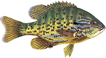
Orange-spotted Sunfish

Orange-spotted Sunfish
Season Start Date
Season End Date
Sport Limit
50
Conservation Limit
25

Pumpkinseed, Bluegill, Green Sunfish, Northern Sunfish, and Orange-spotted Sunfish limits combined

Pink Salmon

Pink Salmon
Season Start Date
Season End Date
Sport Limit
5
Conservation Limit
2

Total daily catch and possession limit for all trout, salmon and splake species combined

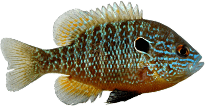
Pumpkinseed

Pumpkinseed
Season Start Date
Season End Date
Sport Limit
50
Conservation Limit
25

Pumpkinseed, Bluegill, Green Sunfish, Northern Sunfish, and Orange-spotted Sunfish limits combined

Rainbow Trout

Rainbow Trout
Season Start Date
Season End Date
Sport Limit
5
Conservation Limit
2

Total daily catch and possession limit for all trout, salmon and splake species combined

Sauger

Sauger
Season Start Date
Season End Date
Sport Limit
4
Conservation Limit
2

Not more than 1 greater than 46 cm ( 18" )

Walleye and Sauger limits combined

Sauger
Season Start Date
Season End Date
Sport Limit
4
Conservation Limit
2

Not more than 1 greater than 46 cm ( 18" )

Walleye and Sauger limits combined

Smallmouth Bass

Smallmouth Bass
Season Start Date
Season End Date
Sport Limit
6
Conservation Limit
2

Total daily catch and possession limit for all largemouth and smallmouth bass combined

Splake

Splake
Season Start Date
Season End Date
Sport Limit
5
Conservation Limit
2

Total daily catch and possession limit for all trout, salmon and splake species combined

Walleye

Walleye
Season Start Date
Season End Date
Sport Limit
4
Conservation Limit
2

Not more than 1 greater than 46 cm ( 18" )

Walleye and Sauger limits combined

Walleye
Season Start Date
Season End Date
Sport Limit
4
Conservation Limit
2

Not more than 1 greater than 46 cm ( 18" )

Walleye and Sauger limits combined

Walleye
Additional Fishing Opportunities
Season Start Date
Season End Date
Sport Limit
2
Conservation Limit
1

Exceptions

  • Chateau Lake (46°05′35″N., 78°00′43″W.) - Maria Township

must be greater than 50 cm ( 19 3/4" )

  • Black Donald Lake (45°13′01″N., 76°56′23″W.) - Brougham Township
  • Centennial Lake (45°09′15″N., 77°03′09″W.) - Matawatchan Township
  • Golden Lake (45°34′26″N., 77°20′10″W.) - North Algona Township
  • Lake Doré (45°37′12″N., 77°06′47″W.) - Wilberforce Township
  • Meadow Lake (45°26′14″N., 77°08′31″W.) - Sebastopol Township
  • Mud Lake (45°24′59″N., 77°09′52″W.) - Sebastopol Township

Walleye and Sauger limits combined

White Crappie

White Crappie
Season Start Date
Season End Date
Sport Limit
30
Conservation Limit
10

Total daily catch and possession limit for white and black crappie combined.

Yellow Perch

Yellow Perch
Season Start Date
Season End Date
Sport Limit
50
Conservation Limit
25