Last Updated: December 31, 2024
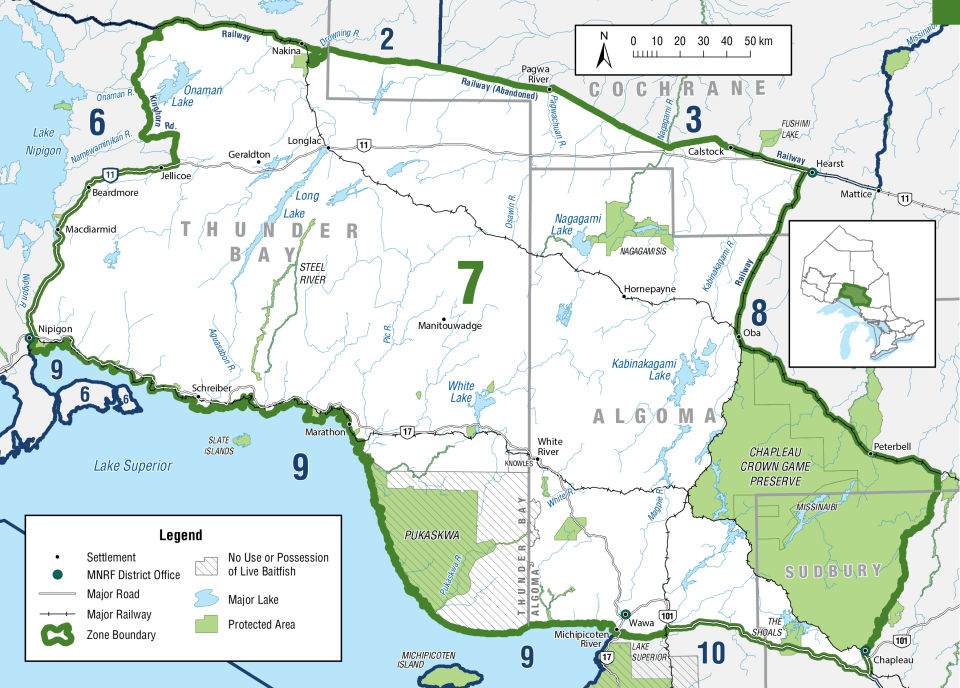
  • The following waterbodies, or portions of them, have different regulations that are listed in the Waterbody exceptions: *New* Borealis Lake, Dayohessarah and Little Dayohessarah Lakes, Dog Lake, Kabinakagami River, Magpie River, Michipicoten River, Nagagami River, Oba Lake and River, Onaman Lake, Rock Lake, Three Finger Lake, and Wabatongushi Lake.
  • The following species are not present in this Zone and are closed to fishing all year: Crappie, Muskellunge and Channel Catfish
  • FMZ 7 is part of the Northwest Bait Management Zone (BMZ). Live or dead baitfish or leeches may not be transported into or out of a BMZ. These rules do not apply to baitfish and leeches which are both dead and preserved.

Zone-wide Seasons and Limits

  • Not in Season
  • Open in Limited Locations
  • Open Season
Show All

Atlantic Salmon

Atlantic Salmon
Season Start Date
Season End Date
Sport Limit
1
Conservation Limit
0

Total daily catch and possession limit for all trout, salmon and splake species combined

Aurora Trout

Aurora Trout
Season Start Date
Season End Date
Sport Limit
1
Conservation Limit
0

Live fish may not be used as bait or possessed for use as bait

Only available in

  • Borealis Lake (49°00'43"N., 86°44'08"W.)

Black Crappie

Black Crappie
Season Start Date
Season End Date
Closed to fishing
Closed to fishing

Not present in this Zone and are closed to fishing all year

Bluegill

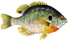
Bluegill
Season Start Date
Season End Date
Sport Limit
50
Conservation Limit
25

Pumpkinseed, Bluegill, Green Sunfish, Northern Sunfish, and Orange-spotted Sunfish limits combined

Brook Trout

Brook trout
Season Start Date
Season End Date
Sport Limit
5
Conservation Limit
2

Sport Limit: not more than 2 greater than 30 cm ( 12" ), of which not more than 1 greater than 40 cm ( 15 3/4" )

Conservation Limit: not more than 1 greater than 30 cm ( 12" ), of which none greater than 40 cm ( 15 3/4" )

Total daily catch and possession limit for all trout, salmon and splake species combined

Brook trout
Additional Fishing Opportunities
Season Start Date
Season End Date
Sport Limit
5
Conservation Limit
2

No size limit

  • Ambrose Lake (48°54′58″N., 87°21′46″W.)
  • Angel Lake (48°46′02″N., 86°52′10″W.) - Tuuri Township
  • Arnott 19 (49°35′26″N., 84°39′33″W.) - Arnott Township
  • Ashmore Lake (48°51′50″N., 87°11′09″W.) - Priske Township
  • Atkinson Lake 1 (48°31′07″N., 84°45′55″W.) - Atkinson Township
  • Ault Lake (48°57′56″N., 87°37′32″W.) - Yesno Township
  • Belanger Lake (49°07′47″N., 84°36′12″W.) - Lascelles Township
  • Bews Lake (48°51′31″N., 87°03′18″W.) - Strey Township
  • Big Lake (48°09′50″N., 84°30′04″W.) - Cowie Township
  • Bittern Lake (48°27′35″N., 83°15′07″W.) - Lerwick Township
  • Bluebill Lake (48°56′37″N., 87°40′23″W.) - Yesno Township
  • Bluff Lake (48°57′21″N., 87°14′58″W.)
  • Bob Lake (49°22′23″N., 85°51′13″W.)
  • Boobus Lake (49°28′14″N., 87°09′19″W.)
  • Botham Lake (48°41′44″N., 85°58′08″W.) - Bomby Township
  • Buck Lake (48°38′28″N., 85°23′21″W.) - Cecile Township
  • Cantin Lake (49°37′20″N., 84°37′02″W.) - Arnott Township
  • Centennial Lake (47°54′51″N., 84°42′51″W.) - Naveau Township
  • Chain Lake (49°26′03″N., 85°49′44″W.)
  • Chapman Lake (49°04′53″N., 87°18′21″W.)
  • Charlotte Lake (48°57′41″N., 87°16′07″W.)
  • Claire Lake (49°37′00″N., 84°36′45″W.) - Arnott Township
  • Clearwater Lake (48°40′19″N., 85°13′53″W.) - Common Township
  • Cruise Lake (48°13′25″N., 84°54′26″W.) - Lalibert Township
  • Curry Lakes A (47°55′55″N., 84°03′01″W.) - Recollet Township
  • Curry Lakes B (47°55′31″N., 84°03′08″W.) - Recollet Township
  • Curry Lakes C (47°55′23″N., 84°03′26″W.) - Recollet Township
  • Dead Lake (48°37′40″N., 85°23′10″W.) - Cecile Township
  • Deadman Lake (49°25′13″N., 86°15′48″W.)
  • Deep Lake (48°56′09″N., 87°15′06″W.)
  • Dew Lake (48°49′14″N., 86°58′45″W.) - Syine Township
  • Disappointment Lake (48°08′38″N., 84°27′27″W.) - Cowie Township
  • Doran Lake (49°06′55″N., 84°37′57″W.) - Larkin Township
  • Dragline Lake (48°38′04″N., 85°24′21″W.) - Cecile Township
  • Drop Lake (48°49′43″N., 86°59′15″W.) - Syine Township
  • Dycie Lake (47°56′11″N., 84°45′28″W.) - McMurray Township
  • East Shell Lake (48°27′22″N., 85°07′15″W.) - Vasiloff Township
  • Echo Lake (48°47′07″N., 86°54′07″W.) - Syine Township
  • Emerald Lake (49°09′09″N., 85°36′17″W.) - Nickle Township
  • Emond Lake (49°36′41″N., 84°39′36″W.) - Arnott Township
  • Empire Lake (49°36′56″N., 87°56′15″W.) - Summers Township
  • Eric Lake (49°36′57″N., 84°38′60″W.) - Arnott Township
  • Eric Lake (48°51′11″N., 86°54′56″W.) - Syine Township
  • Evelyn Lake (49°37′26″N., 84°36′04″W.) - Arnott Township
  • Fire Hill Lake (49°01′20″N., 88°07′40″W.) - Corrigal Township
  • Flats Lake (48°56′54″N., 87°40′27″W.) - Yesno Township
  • Fog Lake (48°54′40″N., 87°07′40″W.)
  • Francoise Lake (48°28′56″N., 84°17′22″W.) - St Julien Township
  • Furnival Lake (48°13′04″N., 84°55′40″W.) - Knicely Township
  • Gagnon Lake (49°37′36″N., 84°34′45″W.) - Arnott Township
  • Gaug Lake (49°08′22″N., 85°51′48″W.) - Leslie Township
  • Gordon Lake (48°51′14″N., 86°54′11″W.) - Syine Township
  • Haf Lake (48°16′42″N., 84°04′53″W.) - Copenace Township
  • Hartley Lake (49°28′43″N., 87°08′40″W.)
  • Hilder Lake (49°46′51″N., 86°58′46″W.) - Fulford Township
  • Hob Lake (49°30′12″N., 86°30′03″W.)
  • Hook Lake (49°33′33″N., 84°37′15″W.) - McEwing Township
  • Igloo Lake (47°57′35″N., 83°20′33″W.) - D’Arcy Township
  • Jason Lake (48°50′42″N., 87°21′11″W.) - Killraine Township
  • Jerrards Lake (48°29′16″N., 85°11′07″W.) - Vasiloff Township
  • Jo-Jo Lake (Minnow Lake) (50°10′34″N., 86°46′25″W.) - Exton Township
  • Jubilee Lake (47°58′50″N., 84°44′53″W.) - McMurray Township
  • Kabossakwa Pothole Lake (48°51′30″N., 85°24′23″W.) - Mikano Township
  • Klein Lake (48°56′35″N., 85°15′25″W.) - Welsh Township
  • Lake 34 (49°11′17″N., 85°35′50″W.) - Nickle Township
  • Lake 35 (49°11′26″N., 85°35′24″W.) - Nickle Township
  • Lake 36 (49°10′54″N., 85°36′09″W.) - Nickle Township
  • Lake E-11 (50°06′05″N., 86°26′41″W.) - Nettleton Township
  • Lamont Lake (48°48′28″N., 87°14′07″W.) - Priske Township
  • Lena Lake (Leana Lake) (49°49′56″N., 86°20′47″W.)
  • Leo’s Lake (48°33′48″N., 85°12′36″W.) - Hunt Township
  • Lewis Lake (49°37′26″N., 84°36′29″W.) - Arnott Township
  • Limestone Lake (49°06′40″N., 88°09′40″W.)
  • Little Flood Lake (48°45′47″N., 85°24′24″W.) - Flood Township
  • Little Hart Lake (49°43′29″N., 84°17′56″W.) - Gill Township
  • Little Harvie Lake (49°01′12″N., 87°11′17″W.)
  • Lovely Lake (49°07′21″N., 84°36′02″W.) - Lascelles Township
  • Lower Ross Lake (48°53′57″N., 87°20′18″W.)
  • Manton Lake (48°06′55″N., 84°07′01″W.) - Echum Township
  • McAvay Lake (49°18′48″N., 88°06′33″W.)
  • Mercury Lake (48°29′18″N., 85°33′23″W.)
  • Mickey Lake (48°59′45″N., 85°52′30″W.)
  • Middleton Lake (49°30′23″N., 86°29′30″W.)
  • Mikano Pothole Lake (48°50′38″N., 85°20′07″W.) - Mikano Township
  • Mile 30 Lake (50°05′14″N., 86°28′16″W.) - Raynar Township
  • Mileage 10 Pothole Lake (48°29′02″N., 85°09′08″W.) - Chapais Township
  • Minnow Lake (48°51′12″N., 87°05′21″W.) - Strey Township
  • Minto Lake (47°58′18″N., 84°45′00″W.) - McMurray Township
  • Mole Lake (49°33′41″N., 84°34′50″W.) - McEwing Township
  • Murphy Lake (49°37′32″N., 84°36′51″W.) - Arnott Township
  • Myrtle Lake (49°38′09″N., 84°34′46″W.) - Arnott Township
  • Mystery Lake (48°19′42″N., 84°43′30″W.) - Dumas Township
  • Nik Lake (48°08′37″N., 84°45′22″W.) - Musquash Township
  • Norn Lake (49°07′16″N., 84°37′29″W.) - Larkin Township
  • North O’Brien Lake (48°32′30″N., 85°08′25″W.) - Abraham Township
  • North Oganek Lake (48°33′55″N., 85°07′46″W.) - Abraham Township
  • North Twin Lake (48°38′09″N., 85°23′53″W.) - Cecile Township
  • Norwalk Lake (47°55′33″N., 84°44′57″W.) - Rabazo Township
  • O’Brien Lake (48°32′41″N., 85°08′13″W.) - Abraham Township
  • Other Man’s Lake (49°05′29″N., 84°45′19″W.) - Larkin Township
  • Pearkes Lake 10 (48°31′48″N., 84°25′18″W.) - Pearkes Township
  • Pointing Lake (49°31′11″N., 84°42′21″W.) - Frost Township
  • Post Lake (49°29′48″N., 86°36′06″W.)
  • Rice Lake (49°44′46″N., 84°17′15″W.) - Gill Township
  • Rod and Gun Lake (47°59′51″N., 84°50′03″W.) - Lendrum Township
  • Rootcellar Lake (48°24′38″N., 85°00′08″W.) - Ashley Township
  • Rope Lake (49°02′21″N., 87°19′30″W.)
  • Sand Lake (49°07′32″N., 85°54′02″W.) - Leslie Township
  • Setting Duck Lake (49°40′49″N., 87°32′53″W.) - Leduc Township
  • Shaw Lake (49°07′34″N., 84°36′47″W.) - Larkin Township
  • Sider Lake (49°37′01″N., 84°35′07″W.) - Arnott Township
  • Slim Lake (49°34′15″N., 84°40′44″W.) - McEwing Township
  • Souloup Lake (48°19′12″N., 84°43′04″W.) - Dumas Township
  • Souter Lake (49°35′22″N., 84°35′59″W.) - Arnott Township
  • South O’Brien Lake (48°32′07″N., 85°08′39″W.) - Vasiloff Township
  • South Shell Lake (48°26′58″N., 85°07′49″W.) - Alanen Township
  • South Twin Lake (48°37′56″N., 85°24′11″W.) - Cecile Township
  • Southpine Lake (49°01′57″N., 87°13′17″W.)
  • Spectacle Lake (48°50′15″N., 87°17′37″W.) - Killraine Township
  • Spring Lake (49°41′00″N., 87°31′44″W.) - Leduc Township
  • Square Lake (47°52′01″N., 83°43′32″W.) - Gilliland Township
  • That Man’s Lake (49°05′42″N., 84°44′58″W.) - Larkin Township
  • Tricorn Lake (49°30′43″N., 86°31′35″W.)
  • Trodd Lake (49°36′15″N., 84°39′35″W.) - Arnott Township
  • Turtle Lake (48°45′20″N., 85°22′12″W.) - Flood Township
  • Upper Ross Lake (48°54′49″N., 87°20′12″W.)
  • Violet Lake (48°33′53″N., 84°30′11″W.) - Cudney Township
  • West Lake (48°06′20″N., 84°07′58″W.) - Echum Township
  • West Shell Lake (48°27′31″N., 85°07′43″W.) - Vasiloff Township
  • Wilson Lake (49°07′37″N., 84°36′29″W.) - Lascelles Township

Total daily catch and possession limit for all trout, salmon and splake species combined

Brook trout
Additional Fishing Opportunities
Season Start Date
Season End Date
Sport Limit
1
Conservation Limit
0

must be greater than 56 cm

  • All tributaries to Lake Superior in Zone 7 described as follows:
    • Jackfish River - downstream from the falls (49°03′N., 88°06′W.)
    • Jackpine River - downstream from Wilson’s Falls (49°07′N., 87°53′W.)
    • Cypress River - downstream from falls (48°57′N., 87°50′W.)
    • Cypress River - west tributary downstream from the falls (48°57′N., 87°51′W.)
    • Gravel River - downstream from the falls (48°55′26″N., 87°41′46″W.)
    • Little Gravel River - downstream from the falls (48°56′01″N., 87°46′36″W.)
    • Steel River - downstream from the Golden Staircase (outflow of Santoy Lake)
    • McKellar River - downstream from the falls 150 metres north of Highway 17
    • Prairie River - downstream from the first hydro line north of Lake Superior
    • From the east shore of the Nipigon River to Camp 81 Road, all tributaries lying downstream from Highway 17, excluding those listed in the first nine sub-bullets above
    • From Camp 81 Road east to the Whitesand River (48°50′N., 87°24′W.), all tributaries lying downstream from the first hydro line north of Lake Superior, excluding those listed in the first nine sub-bullets above
    • From and including the Whitesand River to the west shore of the Pic River all tributaries lying downstream from Highway 17, excluding those listed in the first nine sub-bullets above
    • All tributaries to Lake Superior in Zone 7 from the Pic River to the Michipicoten River, inclusive, downstream from the first falls, rapids, dam or lake or the entire tributary if there are no falls, rapids, dams or lakes

Total daily catch and possession limit for all trout, salmon and splake species combined

Brook trout
Additional Fishing Opportunities
Season Start Date
Season End Date
Sport Limit
2
Conservation Limit
1

No size limit

  • Buckaday Lake (48°58′52″N., 87°45′06″W.) - including headwaters lakes
  • Macutagon Ponds (49°07′24″N., 85°37′19″W.) - Cecil Township
  • All waters in the Townships of Broughton, Atkinson, Cooper, Doucette, Nameigos, McGowan and Mosambik
  • Missing Lake (48°00′07″N., 85°29′08″W.)
  • Waters east of Pukaskwa National Park - within the following boundary: beginning at the southwest corner of Legarde Township, then west along the projection of the southeast boundary of Legarde Township, to the east boundary of Pukaskwa National Park, then northerly along the Park Boundary to the northeast corner of Pukaskwa National Park, then in a straight line easterly to the northwest corner of Memaskwash Township, then east along the north boundary of Memaskwash Township, then south along the east boundary of Memaskwash Township and Charbonneau Township, then west along the south boundary of Charbonneau Township, then south along the east boundary of Keating Additional and Legarde Additional to the beginning; and including the waters of Little Beaver Lake (48°14′13″N., 85°19′19″W.), Coronation Creek, Coronation Lake (48°15′57″N., 85°18′51″W.) and their tributaries in Keating Township; and the tributaries of Farewell Creek in Legarde Township; but not including the waters of East Pukaskwa Lake (48°06'12″N., 85°37'00"W.)

Total daily catch and possession limit for all trout, salmon and splake species combined

Brown Trout

Brown Trout
Season Start Date
Season End Date
Sport Limit
5
Conservation Limit
2

Total daily catch and possession limit for all trout, salmon and splake species combined

Channel Catfish

Channel Catfish
Season Start Date
Season End Date
Closed to fishing
Closed to fishing

Not present in this Zone and are closed to fishing all year

Chinook Salmon

Chinook Salmon
Season Start Date
Season End Date
Sport Limit
5
Conservation Limit
2

Total daily catch and possession limit for all trout, salmon and splake species combined

Coho Salmon

Coho Salmon
Season Start Date
Season End Date
Sport Limit
5
Conservation Limit
2

Total daily catch and possession limit for all trout, salmon and splake species combined

Green Sunfish

Green Sunfish
Season Start Date
Season End Date
Sport Limit
50
Conservation Limit
25

Pumpkinseed, Bluegill, Green Sunfish, Northern Sunfish, and Orange-spotted Sunfish limits combined

Lake Sturgeon

Lake Sturgeon
Season Start Date
Season End Date
Closed to fishing
Closed to fishing

Closed all year.

Lake Sturgeon
Additional Fishing Opportunities
Season Start Date
Season End Date
Sport Limit
0
Conservation Limit
0

All waters located within the portion of Zone 7 north of Highway 11 and east of Highway 584

Lake Sturgeon
Additional Fishing Opportunities
Season Start Date
Season End Date
Sport Limit
0
Conservation Limit
0

All waters located within the portion of Zone 7 north of Highway 11 and east of Highway 584

Lake Trout

Lake Trout
Season Start Date
Season End Date
Sport Limit
2
Conservation Limit
1

Total daily catch and possession limit for all trout, salmon and splake species combined

Lake Trout
Additional Fishing Opportunities
Season Start Date
Season End Date
Sport Limit
2
Conservation Limit
1

Additional Fishing Opportunities

  • Arnott Lake (49°35’53”N., 84°36’24”W.) - Arnott Township
  • Bear Trap Lake (48°15’35”N., 87°31’04”W.)
  • Beaton Lake 65 (Loon Lake) (48°58’51”N., 84°47’51”W.) - Beaton Township
  • Big Skunk Lake (49°35’25”N., 84°33’33”W.) - Arnott Township
  • Corine Lake (49°33’21”N., 84°35’44”W.) - McEwing Township
  • McLeod Lake (49°31’52”N., 86°33’13”W.)
  • Raynar Lake (49°58’29”N., 86°29’40”W.) – Raynar Township
  • Redpine Lake (49°38’02”N., 84°32’30”W.) - Arnott Township
  • Young Lake (49°35’27”N., 84°40’02”W.) - Arnott Township

Limits: S-2 and C-1; not more than 1 greater than 56 cm ( 22" )

  • Fernow Lake (49°54’52”N., 86°03’18”W.) - Fernow Township
  • McKay Lake (49°37’14”N., 86°25’19”W.)

Limits: S-1 and C-0

  • Grehan Lake (49°29’N., 86°37’W.)
  • Little Pic Lake (49°22’N., 86°38’W.)
  • Sun Lake (49°25’N., 86°34’W.)Yucca Lake (49°23’N., 86°37’W.)

Total daily catch and possession limit for all trout, salmon and splake species combined

Lake Whitefish

Lake Whitefish
Season Start Date
Season End Date
Sport Limit
25
Conservation Limit
12

Largemouth Bass

Largemouth Bass
Season Start Date
Season End Date
Sport Limit
6
Conservation Limit
2

Total daily catch and possession limit for all largemouth and smallmouth bass combined

Muskellunge

Muskellunge
Season Start Date
Season End Date
Closed to fishing
Closed to fishing

Not present in this Zone and are closed to fishing all year

Northern Pike

Northern Pike
Season Start Date
Season End Date
Sport Limit
6
Conservation Limit
2

Sport Limit: not more than 2 greater than 61 cm ( 24" ), of which not more than 1 greater than 86 cm ( 33 3/4" )

Conservation Limit: not more than 1 greater than 61 cm ( 24" ), none greater than 86 cm ( 33 3/4" )

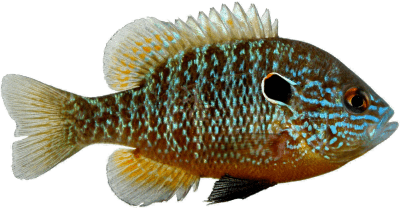
Northern Sunfish

Northern Sunfish
Season Start Date
Season End Date
Sport Limit
50
Conservation Limit
25

Pumpkinseed, Bluegill, Green Sunfish, Northern Sunfish, and Orange-spotted Sunfish limits combined

Orange-spotted Sunfish

Orange-spotted Sunfish
Season Start Date
Season End Date
Sport Limit
50
Conservation Limit
25

Pumpkinseed, Bluegill, Green Sunfish, Northern Sunfish, and Orange-spotted Sunfish limits combined

Pink Salmon

Pink Salmon
Season Start Date
Season End Date
Sport Limit
5
Conservation Limit
2

Total daily catch and possession limit for all trout, salmon and splake species combined

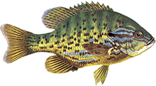
Pumpkinseed

Pumpkinseed
Season Start Date
Season End Date
Sport Limit
50
Conservation Limit
25

Pumpkinseed, Bluegill, Green Sunfish, Northern Sunfish, and Orange-spotted Sunfish limits combined

Rainbow Trout

Rainbow Trout
Season Start Date
Season End Date
Sport Limit
1
Conservation Limit
0

Total daily catch and possession limit for all trout, salmon and splake species combined

Rainbow Trout
Additional Fishing Opportunities
Season Start Date
Season End Date
Sport Limit
5
Conservation Limit
2

Additional Fishing Opportunities

  • Arnott 47 Lake (North Arnott)Balancing Lake (49°49’59”N., 86°18’18”W.)
  • Boobus Lake (49°28’14”N., 87°09’19”W.)
  • Centennial Lake (47°54’51”N., 84°42’51”W.) - Naveau Township
  • Dragline Lake (48°38’04”N., 85°24’21”W.) - Cecile Township
  • Frost 68 Lake (Ronald Lake) (49°29’23”N., 84°42’38”W.) - Frost Township
  • Hart Lake (49°43’53”N., 84°18’27”W.) - Gill Township
  • Hartley Lake (49°28’43”N., 87°08’40”W.)
  • Hilder Lake (49°46’51”N., 86°58’46”W.) - Fulford Township
  • Humberstone Lake (49°30’04”N., 84°42’26”W.) - Frost Township
  • Leana Lake (49°49’56”N., 86°20’47”W.)
  • Lukinto Lake (49°49’02”N., 86°18’40”W.)
  • Margo Lake (49°49’24”N., 86°21’03”W.)
  • North Twin Lake (48°38’09”N., 85°23’53”W.) - Cecile Township
  • Pamela Lake (49°47’15”N., 86°19’36”W.)
  • Tricorn Lake (49°30’43”N., 86°31’35”W.)
  • Unnamed Lake A-620-A (49°47’13”N., 86°58’02”W.) - Fulford Township
  • Unnamed Lake A-717 (49°53’59”N., 86°49’17”W.)

Limits: S-2 and C-1

  • All tributaries to Lake Superior in Zone 7 east of and including the Pic River to the boundary with Zone 10
Total daily catch and possession limit for all trout, salmon and splake species combined

Sauger

Sauger
Season Start Date
Season End Date
Sport Limit
4
Conservation Limit
2

not more than 1 greater than 46 cm ( 18" )

Walleye and Sauger limits combined

Sauger
Season Start Date
Season End Date
Sport Limit
4
Conservation Limit
2

not more than 1 greater than 46 cm ( 18" )

Walleye and Sauger limits combined

Sauger
Additional Fishing Opportunities
Season Start Date
Season End Date
Sport Limit
2
Conservation Limit
1

Limits: S-2; not more than 1 greater than 40 cm, not more than 1 less than 40 cm, and C-1; must be less than 40 cm

  • Obatanga Provincial Park (all waters) including Bogle, Burnfield, Cotton, Knife, Obatanga and Patron Lakes

Limits: S-2 and C-1; any size from these waters combined

  • Maguire, Kapimchigama, Radford, Lund, Lost Sky Pilot, Pashoskoota, Rainbow, Reynolds Lakes, and all connecting waters - Territorial District of Algoma

Walleye and Sauger limits combined

Sauger
Season Start Date
Season End Date
Closed to fishing
Closed to fishing

Season: closed all year

  • Jackfish River - between Nipigon Bay (Lake Superior) and the First Barrier

  • Wabenung Lake (48°24’09”N., 84°47’37”W.) - Carmody Township

Sauger
Additional Fishing Opportunities
Season Start Date
Season End Date
Sport Limit
2
Conservation Limit
1

Limits: S-2; not more than 1 greater than 40 cm, not more than 1 less than 40 cm, and C-1; must be less than 40 cm

  • Obatanga Provincial Park (all waters) including Bogle, Burnfield, Cotton, Knife, Obatanga and Patron Lakes

Limits: S-2 and C-1; any size from these waters combined

  • Maguire, Kapimchigama, Radford, Lund, Lost Sky Pilot, Pashoskoota, Rainbow, Reynolds Lakes, and all connecting waters - Territorial District of Algoma

Walleye and Sauger limits combined

Smallmouth Bass

Smallmouth Bass
Season Start Date
Season End Date
Sport Limit
6
Conservation Limit
2

Total daily catch and possession limit for all largemouth and smallmouth bass combined

Splake

Splake
Season Start Date
Season End Date
Sport Limit
5
Conservation Limit
2

Total daily catch and possession limit for all trout, salmon and splake species combined

Walleye

Walleye
Season Start Date
Season End Date
Sport Limit
4
Conservation Limit
2

not more than 1 greater than 46 cm ( 18" )

Walleye and Sauger limits combined

Walleye
Season Start Date
Season End Date
Sport Limit
4
Conservation Limit
2

not more than 1 greater than 46 cm ( 18" )

Walleye and Sauger limits combined

Walleye
Additional Fishing Opportunities
Season Start Date
Season End Date
Sport Limit
2
Conservation Limit
1

Limits: S-2; not more than 1 greater than 40 cm, not more than 1 less than 40 cm, and C-1; must be less than 40 cm

  • Obatanga Provincial Park (all waters) including Bogle, Burnfield, Cotton, Knife, Obatanga and Patron Lakes

Limits: S-2 and C-1; any size from these waters combined

  • Maguire, Kapimchigama, Radford, Lund, Lost Sky Pilot, Pashoskoota, Rainbow, Reynolds Lakes, and all connecting waters - Territorial District of Algoma

Walleye and Sauger limits combined

Walleye
Season Start Date
Season End Date
Closed to fishing
Closed to fishing

Season: closed all year

  • Jackfish River - between Nipigon Bay (Lake Superior) and the First Barrier

  • Wabenung Lake (48°24’09”N., 84°47’37”W.) - Carmody Township

Walleye
Additional Fishing Opportunities
Season Start Date
Season End Date
Sport Limit
2
Conservation Limit
1

Limits: S-2; not more than 1 greater than 40 cm, not more than 1 less than 40 cm, and C-1; must be less than 40 cm

  • Obatanga Provincial Park (all waters) including Bogle, Burnfield, Cotton, Knife, Obatanga and Patron Lakes

Limits: S-2 and C-1; any size from these waters combined

  • Maguire, Kapimchigama, Radford, Lund, Lost Sky Pilot, Pashoskoota, Rainbow, Reynolds Lakes, and all connecting waters - Territorial District of Algoma

Walleye and Sauger limits combined

White Crappie

White Crappie
Season Start Date
Season End Date
Closed to fishing
Closed to fishing

Not present in this Zone and are closed to fishing all year

Yellow Perch

Yellow Perch
Season Start Date
Season End Date
Sport Limit
50
Conservation Limit
25